Supportive maps
This Appendix will support maps referenced in the body of the Master Plan 2020 document.
|
|
Profile Maps
The following maps provide the profile of the Village of Herkimer as recorded in the Herkimer Oneida Counties Comprehensive Planning Program (thanks to Jeffrey Quackenbush/GIS Coordinator, and Matthew Pawlusik/GIS Tech II).
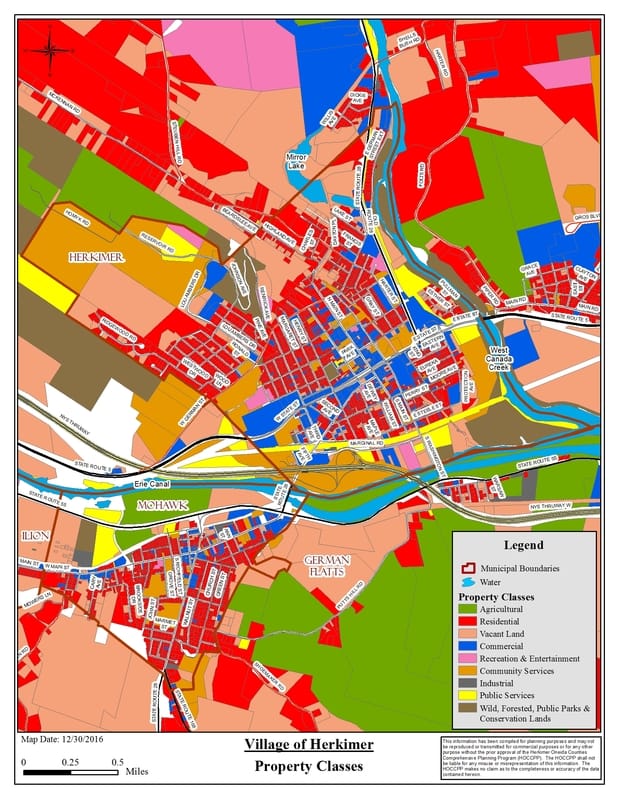
The first map is one that details the Property Class Codes for the Village. This is the profile as it exists in 2016. Note that the Master Plan 2020 will be recommending an initiative to review this zoning and identify what changes are required to set the stage for the future profile of the Village of Herkimer. It is expected that the future profile will result in changes to this map.
The following maps provide the profile of the Village of Herkimer as recorded in the Herkimer Oneida Counties Comprehensive Planning Program (thanks to Jeffrey Quackenbush/GIS Coordinator, and Matthew Pawlusik/GIS Tech II).
The first map is one that details the Property Class Codes for the Village. This is the profile as it exists in 2016. Note that the Master Plan 2020 will be recommending an initiative to review this zoning and identify what changes are required to set the stage for the future profile of the Village of Herkimer. It is expected that the future profile will result in changes to this map.
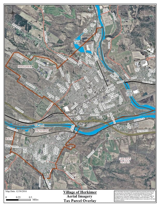
The second map is one that provides an Arial Photograph with the Tax Parcel Overlay for the Village. This is the profile as it exists in 2016. Note that the Master Plan 2020 will be recommending an initiative to review the zoning and identify what changes are required to set the stage for the future profile of the Village of Herkimer. It is expected that the future profile will result in changes to this map.
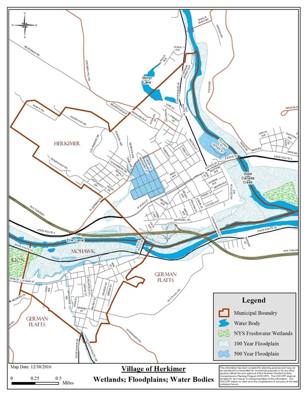
The third map is one a map detailing all of the Wetlands and Floodplains for the Village. This is the profile as it exists in 2016. Note that the Master Plan 2020 will be required to respect these areas designated as Wetlands regarding restrictive development and consider the areas noted as Floodplains for development of supporting flood management plans.
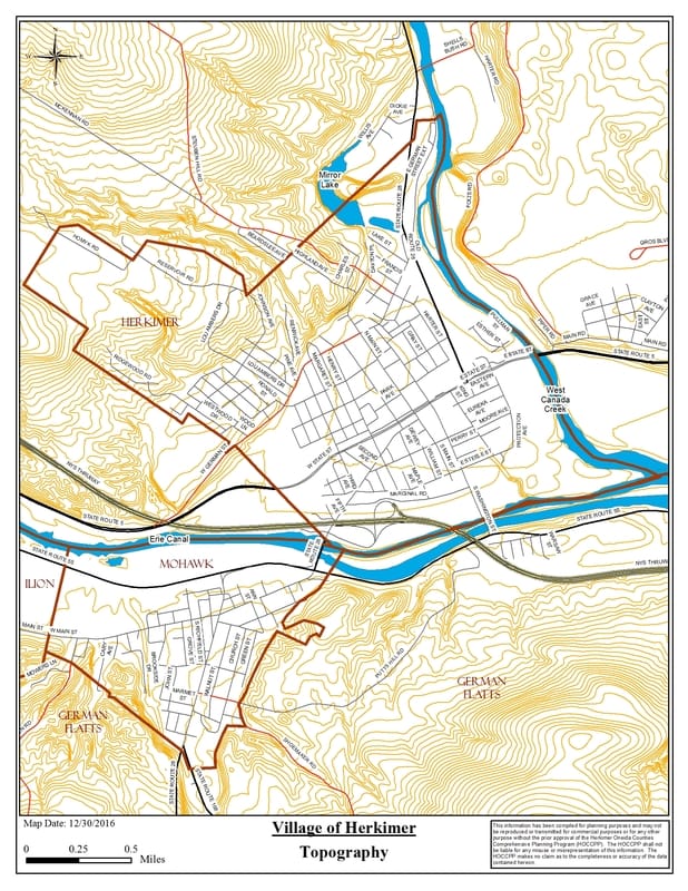
The fourth map is one that is supportive of the section on Topology, providing a detailed Topological profile of the Village of Herkimer. Note that the Master Plan 2020 will take into account topological influences when developing the future profile of the Village of Herkimer.